2023.08 Update

Updates:

  • Rendering of machinery. You can sync and see John Deere equipment in Geoface.
  • Editing of variable rate maps. You can now import, generate and edit variable rate fertilization maps.
  • Product purchasing. You can now add multiple products in one purchase.
  • Plant protection journal update. Now you can select the period and fields you want to declare.
  • Updated mobile version of Geoface.
  • Updated job colors in the finance section.

Fixes:

  • Fixed a problem where the area of grouped fields was duplicated.
  • Fixed map focus in the job calendar.
  • Fixed the filter in the finance section

Smart farming systems on farms are inevitable

The global market for farm management software is expected to double by 2026, while only 30% of farms in Lithuania have implemented or plan to start using precision farming solutions. The developers of the Lithuanian smart app Geoface argue that, despite established habits or fear of change, farms will not avoid digitalisation due to legal regulations, cost benefits and the attitude of the younger generation.

The world’s growing human population and the need to feed it, the demands of sustainability and the drive for value for money are driving agriculture to find ways to get the most out of every hectare. Farm managers have to make decisions here and now, which calls for automated farm management solutions. Smart farming systems are gaining in popularity, which helps to store farm data in one place, predict yields, monitor machinery and equipment, carry out mandatory reports, etc.

The global market for farm management applications is expected to double by 2026. Today it stands at $2.1 billion and is expected to grow to $4.2 billion by 2026 (source: www.marketsandmarkets.com). Europe accounts for about 10% of the total global market and Lithuania would account for an even smaller share, but the use of farm management applications is expected to grow rapidly. Growth is mainly driven by the modernisation of farms, the changing generation of farms, government support programmes and various legal frameworks.

In the Lithuanian market, only around 30% of advanced farms have installed or plan to start using precision farming solutions such as RTK signals, fertiliser maps, other software and automated driving. Unfortunately, many farms still document their work in a notebook or do not analyse it at all. The main reason is fear of innovation. Some Lithuanian farms are still distrustful of digital solutions – they are expensive, the benefits are not tangible, there is a lack of skills, and there is a fear of losing data.

Jonas Bakšys, Director of Geoface, a company developing a smart farming programme, says that smart systems are an inevitable tool for farms. “Not only does it help to manage farm information, calculate costs, forecast yields and income. It is a necessity and the norm when farm data becomes another important resource to achieve a profitable farm result,” says Jonas Bakšys.

With rising prices for machinery and equipment, fuel, crop protection products, fertilisers and labour costs, farms are forced to think about how to earn more. For example, smart farming systems can help reduce fertiliser inputs efficiently. Integrating aggregated field data and using nitrogen fertiliser maps can save up to 15% of nitrogen, which reduces costs, lowers the risk of crop spoilage and improves grain quality.

Sustainability is and will continue to be of particular importance for farm decisions. Farmers are subject to a wide range of requirements to farm sustainably, sustainably and organically. By 2030, agriculture will need to reduce pesticide use and risks by 50% and fertiliser use by at least 20%. Mandatory accounting to monitor pesticide use is on the increase. This is also helped by the declaration functionality of the smart system, where declarations of the use of plant protection products have been mandatory since last year.

One of the more important conditions for digitisation is the age of the farm manager. In Lithuania, statistics show that only 17% of farm owners are under 40 years of age, even though more and more young people are directly involved in farm management. Young people are willing to work in a different way from the way their parents and grandparents worked. And they are older too – once they have tried a programme, they do not want to go back. Farms, especially the younger generation, need digital solutions to store and make use of farm data. More and more farms are deciding to farm more efficiently and connecting to smart farming systems.

Jonas Bakšys, Director of Geoface UAB, is pleased with Geoface, a unique application that Linas Agro Group has been developing for the Baltic market for several years, which helps to combine the needs of crop farms into one convenient smart farming tool in Lithuanian, Latvian and English.

“The experience of hundreds of farmers and the concrete expectations they express every day have been used to develop the Geoface app. Launched in 2019, the system already has more than 2,300 users signed up. In the second half of 2022, twice as many new users have joined as in 2021, and in January 2023 as many as five times more than in January 2022. In Lithuania and Latvia, we are spending a lot of time on improving the functionality of the app, as well as on customer consulting and training,” says the CEO of Geoface .

Geoface – Digital farm management system made in Lithuania

What do you need for the best farm management program?

As we move towards digital tools, we expect them to be a help first and foremost, not an additional hassle. Simplicity is therefore the most important thing for a farm management application to have. The right apps are designed to minimize the number of clicks required, by putting all the steps in a way that farmers can understand and use, and by providing all the tools they need to make farm management more convenient. We do this by constantly consulting with farmers of all sizes, agronomists, agricultural scientists, and global best practices. What are the specific benefits and opportunities for our Geoface users?

Convenient field contribution

In order to get started with smart agricultural management applications, we are always asked to specify our fields. The most common way to specify fields is to use the “drawing” tool to draw the field boundaries. This method is slow and unattractive. In Geoface you will of course find this method too, but it is much more modern. For example, importing fields from the EAA with a few clicks of a button. Another convenient and interesting way is by selecting the desired fields on the provided map according to the previous year’s

declarations. Geoface offers a total of 6 different ways to contribute fields to the application. From the very first experience of using the application, we want to show that Geoface is different. Geoface is focused on convenience and simplicity.

Field monitoring with FAPAR (NDVI) index

Once the fields have been loaded, one of the most well-known features of such applications becomes available to you – remote field monitoring on a map. A regular satellite map is displayed where you can conveniently mark your fields. Once marked, you can see the area and the block number, and, using the FAPAR (NDVI) index, you can monitor the vegetation status of the field. Using modern technology, satellites, spectral cameras, and sophisticated algorithms, we are able to monitor and record changes in the vegetation of a field every three days. After processing the algorithms, we share the pictures with you, enabling you to monitor problem areas in the field. When you see huge irregularities in vegetation, you can look for problems in the drainage system, in the soil, or elsewhere.

It’s not just fields and their vegetation that you can see on the Geoface map. Geoface allows you to activate drainage schemes, pinpoint your exact location, and save drainage systems by reclaiming their estuaries. You can also use a handy exploration tool where you can mark points in the field and assign photos and comments to them. This allows you to monitor your crops or mark important problems such as stones and potholes and share this information with other farm staff.

Quick and easy task planning

The main function of farm management software is work planning. In Geoface, all types of farm work (sowing, fertilizing, spraying) are planned in the same sequence using a standardized template. Customers find the farm work scheduling to be one of the most intuitive and easiest-to-use features of Geoface. The biggest advantage is the high flexibility to adapt to real farm situations. Our planning is done en masse. Automatically selecting all fields of a single crop, with the possibility to exclude some fields from the work plan.
Another much-loved feature of Geoface is the input of the actual quantity used. On the farm, plans rarely correspond to reality. We have therefore developed a function that allows you to enter the actual amount of material used when the work is finished. When you enter the actual quantities of fertilizer or other materials used, everything will be automatically recalculated. This will record the actual quantities used, recalculate and record the real rates and real costs.

Sowing planning

In Geoface, you choose your seeds and fertilizers from an extensive list of products from all major suppliers. If you don’t find the product you are looking for, you can either add it to the list yourself or inform the Geoface team to add the product you want. In the sowing section, you will find the recommended sowing rates as well as a sowing rate calculator where you can use the seed parameters to get the sowing rate you need. You can also add the required nutrients and micronutrients to the planned sowing.

Fertilization planning and variable rate nitrogen fertilization maps

The list of fertilizers is even more extensive, and you can also add products that you cannot find here. Once you have planned, you will also see the amount of active ingredient per hectare, both for the field and for all the planned works combined – no need for a calculator. Also, all fertilizer applications made are automatically transferred to the fertilizer logs, which you no longer need to keep separately. This log is permanently available and can be downloaded in PDF format.
Using the satellite (FAPAR) information described above, we provide a unique opportunity to fertilize your crops with nitrogen at variable rates. Using sophisticated algorithms and after you specify the total, minimum, and maximum fertilizer rates per hectare, we will recalculate the fertilizer rate for the hectare.

Scientists will investigate why Labūnava agricultural company yields are above average

While many farms in Lithuania are striving to maximize their yields, Labūnava agricultural company, one of the most productive farms in Lithuania, is challenging scientists by allowing a study to be carried out in 2023 to find out why the company’s fields are yielding more than the average yield in central Lithuania. Although the scientists have not yet come to a conclusion, the company’s representatives have already agreed to share their practical experience of what is most important for a good harvest: the right cultivation technology, the need to balance plant nutrition, the use of the most intelligent machinery, or the use of accurate field data.

We are talking to Julius Mikaliūnas, an agronomist at Labūnava Agricultural company, and Prof. Gediminas Staugaitis, Head of the Agrochemical Research Laboratory of the Lithuanian Centre of Agrarian and Forestry Sciences and Chief Scientist of “LAMMC”.


What is typical for Central Lithuanian crops? What is the average annual yield in the fields of Labūnava agricultural company?

Professor Gediminas Staugaitis, Ph.D., states that the Labūnava company has been successfully developing its agricultural activities for a number of years, has a long tradition of farming, and produces large and high-quality crops. The farm’s soils are fertile, with a productivity score of 66-69 in the experimental field. The predominant soil is a shallow carbonate brown earth, with carbonates at a depth of 30-40 cm, which gives the soil a neutral reaction (pHKCl 7,0-7,5). The arable layer is very high in mobile phosphorus (P2O5 260-398 mg/kg) and potassium (K2O 196-300 mg/kg). Humus is present in moderate quantities in the field, averaging 2,6 %. Such a field has the potential to produce maximum yields of agricultural crops such as winter wheat of 10 t/ha or more.

Both the professor and Dr. Gabrielė Pšibišauskienė, Head of Agri-technology Development at Linas Agro, share their experience: “According to LAMMC research in central Lithuania (according to the commissioned research by Linas Agro, 2022), in a light sandy loam with a soil pH close to neutral and a low mineral N of 14.5 – 16.0, the soil contains a moderate amount of plant-available phosphorus and potassium. The soil has a relatively low organic matter content and one of the crops in the rotation is legumes. The above aspects of winter wheat production technology are constant over the years and yield values are similar for 10 consecutive years, with winter wheat yields often around 6 t/ha.

According to Julius Mikaliūnas, an agronomist at Labūnava agricultural company, the soils at Labūnava Agricultural Company are close to the above-mentioned trial. The company’s average yield of winter wheat under economic technology in 2022 is 7,9 t/ha. The yield obtained by the company is even significantly higher compared to the results obtained by LAMMC in 2022.

Importantly, the application of agrotechnological measures to restore soil fertility has increased the yield potential of the crops in the Labūnava. Initial insights into the increase and the key agro-technological measure that is driving the change in yield potential of winter wheat will be presented by LAMMC scientists in the company’s fields during the 2023 “Grūdo kelias (Road of the grain)” field day.


Which crop rotation is used in the field under study? What other questions will the study answer?

The company’s rotation for the field under study consists of alfalfa in 2019-2020, winter wheat in 2021, winter oilseed rape in 2022, and winter wheat in 2023. “There are some other major agrotechnological differences between the winter wheat production technology of LAMMC and Labūnava agricultural company: the fields are fertilized after harvest with bird manure every 4 years, the abundance of bean plants in the rotation, and the target rates of phosphorus and potassium fertilization, the application of urea at the seed, etc. The main question to be answered by LAMMC scientists will be the reason for the higher yields in the company”, comments Prof. Dr. Gediminas Staugaitis.


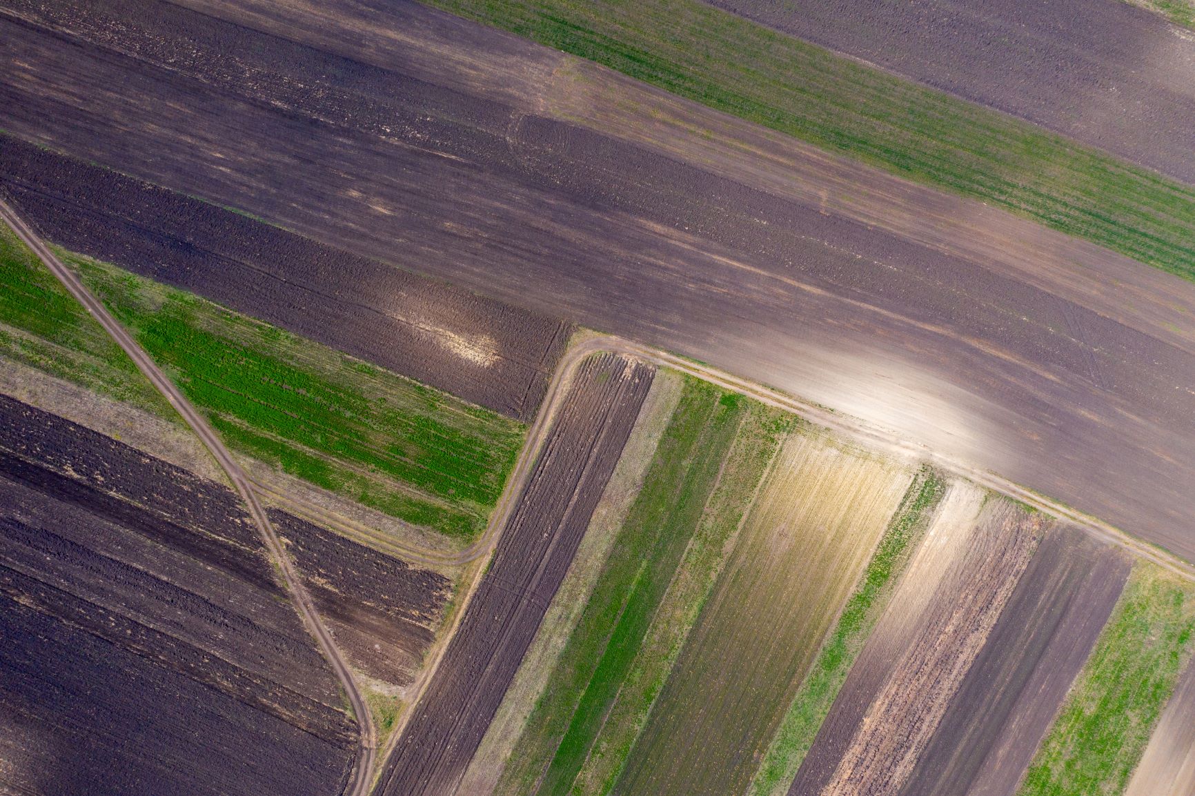
How much fertilizer does Labūnava agricultural company apply to its fields? How has precision fertilization and adjusting the width of the spreader affected the results?

J. Mikaliūnas shares his experience: “In total, we have to fertilize about 1800 ha of fields every year, and the vast majority of them (about 90%) is uneven. Until we had smart spreaders, we were definitely over-fertilizing the uneven areas. With smart spreaders, we can accurately apply different rates of fertilizer to different areas of the field. Precise section control helps us to reduce fertilizer use, avoid overfertilizing neighboring fields, and turn off the spreader at field boundaries to save fertilizer.

So far, the farm is using variable-rate fertilizers only for phosphorus and potassium, but in the future, it plans to use them for nitrogen fertilizers as well. “By using smart farming systems, we can reduce costs. In the past, Labūnava Farm used to fertilize its fields with 360 kg/ha of complex fertilizer for all fields, but after soil testing and the introduction of variable rate maps, we have reduced the fertilizer to 33 kg/ha of potassium fertilizer and 57 kg/ha of phosphorus fertilizer. At current fertilizer prices, a smart fertilizer can pay for itself in the first season on a large farm,” says Mr. Mikaliūnas.

As the company’s yields are significantly higher than the results obtained by LAMMC in 2023, a scientific study will be carried out in order to identify the reasons for the difference in 2023, by determining the potential of the soil over a number of years by applying a targeted phosphorus and potassium fertilization and organic fertilizers.


What digital tools are planned to be used on the farm to make fertilizer application even more accurate?

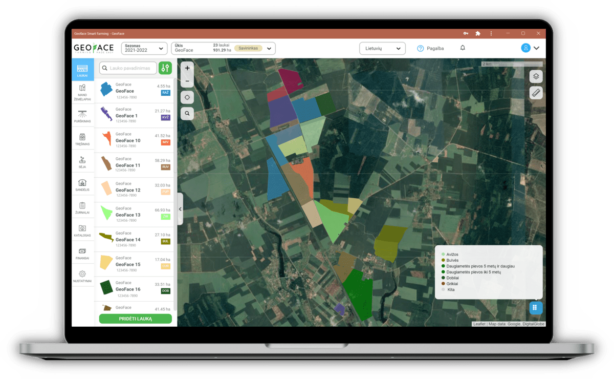
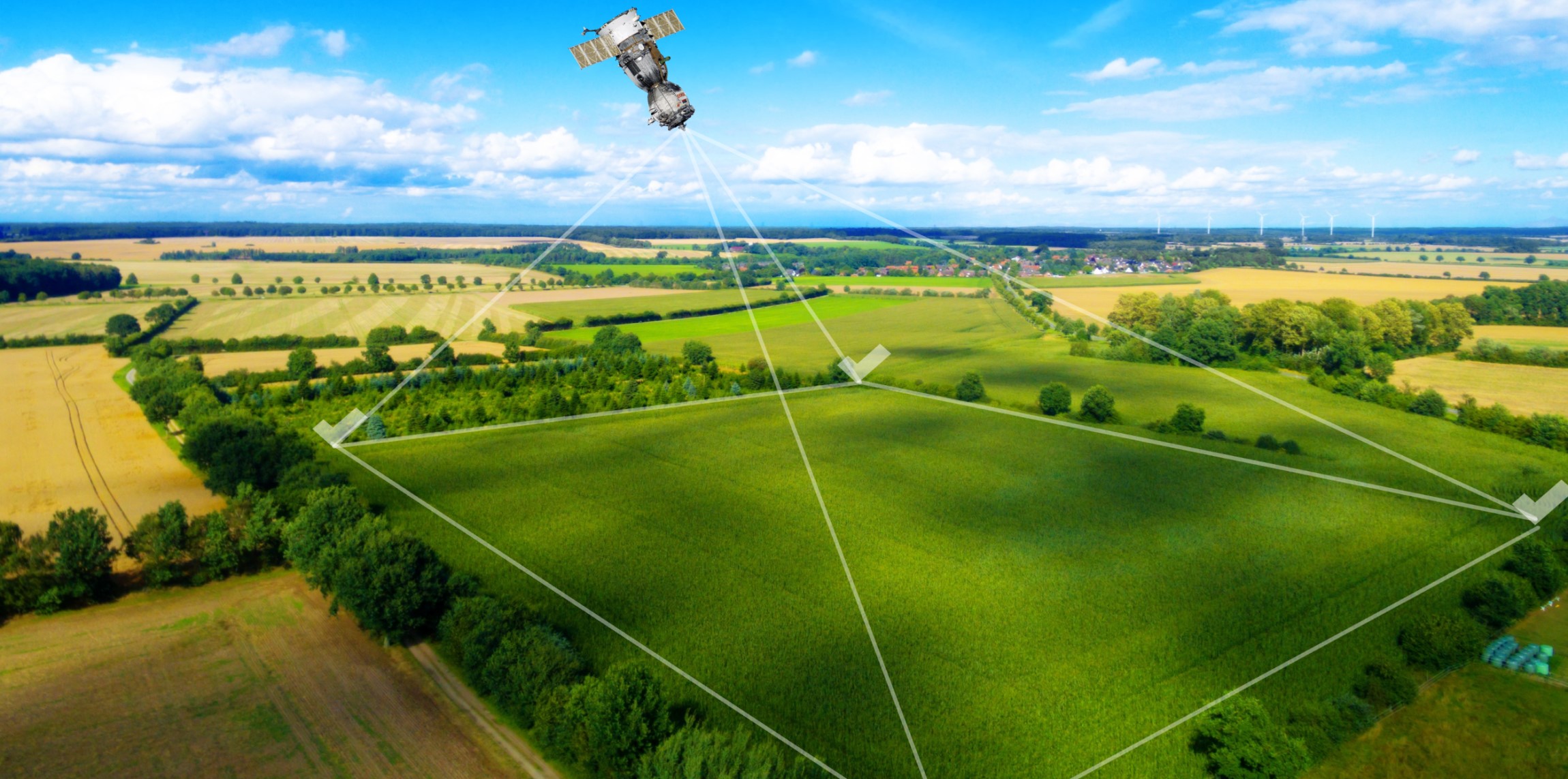
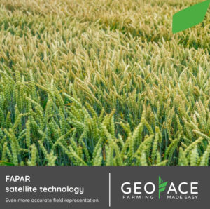
In 2023, the smart farming system Geoface is planned to be launched for the generation of accurate fertilization maps, which will be used to generate variable rate maps for nitrogen fertilizers. The digital application Geoface will provide a clear view of historical data and when to work in the fields. It will be easy to make decisions for future work.

GeoFace agricultural management software has the capability to use satellite data and interpret it with a unique algorithm. It can determine the percentage of fertilizer to be applied in certain areas of the field. This allows the crop to be “evened out” and not to fertilize areas that will not produce the desired result, regardless of the amount of fertilizer applied. The algorithm itself, based on the FAPAR index, analyses the part of the solar spectrum that is absorbed by the chlorophyll in the plants. It models all phases of plant growth, so we can monitor plant changes from the earliest phases and take appropriate decisions before there is a real threat of crop failure.


What measures can lead to sustainable use of the soil’s potential and stability of its value?

In terms of soil and agrochemical properties, the following measures are part of the strategy for the further use of farm fields:

1) the sustainable use of mineral fertilizers to exploit the potential of the soil. Since the soil is very rich in mobile phosphorus and potassium and has a high land productivity score, nitrogen, phosphorus, and potassium fertilizers can be saved, and diagnostic methods of plant nutrition, such as scanning for green leaf pigment and soil and leaf tests, should be used to optimize fertilizer rates;

2) calculation of the optimum input/output balance of humus (organic carbon) and essential nutrients. Changes in humus, nitrogen, phosphorus, and potassium in farm fields should be judged from the annual and longer-term balances of these nutrients in the soil;

3) exploiting the potential properties of the soil by using trace elements and biostimulants.


What does it mean to you that a large-scale project called “Grūdo kelias (Road of the grain)” is being carried out in Labūnava?

“We hope that the results of the research on fertility in Labūnava will be of interest to scientists, farmers, and developers of new technologies. We believe that we need to share good practices and scientific and technological discoveries. It is great that this is happening in Labūnava”, says Julius Mikaliūnas, an agronomist at Labūnava Agricultural company.


Thank you for the interview.

Even more accurate field mapping with FAPAR satellite technology

NDVI FApar skirtumai

Over time, atypical weather conditions have become an increasing source of anxiety and challenges for farmers. Agriculture is the sector most sensitive to a changing climate.

Winter frosts and rainstorms are statistically the most damaging to crops, but these two problems are predicted to be soon overshadowed by increased solar intensity and drought risk. For these reasons, it is necessary to find ways to increase the efficiency of agriculture, reduce losses, optimize processes, and increase yields.

Innovations in satellite technology and newer and better algorithms for agriculture can help solve these problems. The NDVI index is usually the best known, but one of the better algorithms is FAPAR, sometimes also called fAPAR or fPAR. This algorithm analyses the part of the solar spectrum absorbed by chlorophyll in plants.

One of the main advantages of this technology is that the FAPAR index efficiently models all the stages of plant growth and therefore allows for proper monitoring of the situation in the field, whereas other algorithms are not able to monitor the fields from the beginning of the growing season, as the algorithm includes the soil.

In cases where the vegetation is the same across the field, we can use contrast mode so you can see the best and worst parts of the field and make appropriate decisions about whether to use a different cultivation technology or a different tillage method.

Geoface is an intelligent farm management application that uses these algorithms and technologies to best pinpoint problematic areas, monitor changes in fields during the growing season, and predict future yields. With more accurate data, we can start talking about variable rate mapping. Conserve nitrogen fertilizer, only fertilize where needed, do not over-fertilize areas likely to dry out, and do not fertilize areas that will not produce the desired yield.

Another plus point of FAPAR is that satellite imagery and variable-rate maps with this algorithm have a high resolution of up to 10×10 meters. This precision allows you to work without fear of not fertilizing areas that do not need fertilizer.

With FAPAR, you can maximize the potential of your land, take care of the environment and save time and money.


How Geoface smart technologies can benefit the country’s farmers?

The need for new partnerships and modern technological solutions in the agricultural sector is increasingly driven by high environmental demands, climate change and fluctuations in product prices. To help farmers work more efficiently to meet these challenges, Geoface has developed a new precision farming system. It will allow farmers to remotely monitor the situation in their fields, get instant and accurate advice, plan the work they need to do and predict yields, all from the comfort of their homes.


Key Geoface benefits for users:

  • Nitrogen fertilizer mapping – have you ever needed an agronomist to apply variable rate fertilizer to your crops? With Geoface, you can create variable rate nitrogen fertilizer maps in just a few minutes without the need for agronomic knowledge;
  • Viewing reclamation maps – you no longer need to spend time searching for drainage maps for your fields – in Geoface they can be accessed in just two clicks;
  • Harvest forecasting – struggling to plan your seasonal income? With the Yield Forecasting tool, you can get a preliminary idea of future field yields;
  • Working with a team – now it’s even easier to work with specialists and workers on your farm: you can give access to your fields to other users;
  • Keeping a log of spraying, and fertilization tasks – crop maintenance work can be easily, simply and quickly recorded in the app, which keeps a history of the maintenance of each field, the cost structure and profitability;
  • Catalogue of plant protection products, pests and diseases – don’t recognise a pest, disease or weed in your field? The catalogue of pests, diseases and weeds will help you.

These proposals are aimed at encouraging farmers and other companies practising crop production to take an interest in Geoface and even to enter into practical cooperation.


Modern crop technologies in Lithuania

What precision technology in agriculture is has been well defined by scientific institutions. For example, the Vytautas Magnus University’s Academy of Agriculture’s research team, led by Prof. Egidijus Šarauskis, states that “precision agriculture is a technology that combines knowledge of agronomy, informatics and engineering into a single entity, which can be applied in practice in agriculture”.

The development of these precision technologies involves three steps. The first is information gathering. In this case, it is gathered by using GPS communications, photographing and scanning fields, conducting soil surveys and analysing scientific papers published by other authors in the world in this field. The second and most complex step is the processing of the information collected. Knowing the composition of the soil and applying more or less seed or fertilizer is not enough for a farmer to implement precision farming technology. The data collected needs to be processed using information technology algorithms, taking into account the cost-effectiveness and environmental benefits of the decisions taken. Only then can the third step be taken: making recommendations to farmers. The farmer downloads the data into the drill’s computer and travels through the field using the relevant GPS coordinates and a map, while the machinery spreads or inserts the variable rates at specific points in the field.

The latest digital farming system – Geoface is offered at a time of revolutionary change in the country’s farming practices. In particular, direct seeding into uncut stubble and multiple crops spraying with mixtures of fertilizers, growth regulators, biostimulants, bacterial preparations and various types of pesticides have become popular in Lithuania. The European Union (EU) is changing its requirements for agribusiness, and so are Lithuania’s, and conditions are tightening. Therefore, we believe that new smart technologies can help farmers to combine the many different solutions that are applied in crop care.


Will help reduce agronomic errors

Farmers and some researchers have already noticed that the current changes in agronomic factors, which are publicly promoted, do not always have a scientific agronomic basis. Even the EU’s new programmes are not 100% based on detailed theoretical studies. For example, a strict no-tilling system is proposed, which leaves no room for stubble cutting, while at the same time committing to new EU requirements: a 50% reduction in the use of pesticides, a 20% reduction in fertilizer application rates, and a ban on ploughing up permanent grassland (meadows and pastures) to reseed it and thereby increase productivity by at least a factor of 1.5-2.5. Alternatively: direct sowing of stubble on low humus loam soils is proposed, and even in the event of a short-term drought, sowing on cloddy land is possible. The result is low germination of the seed field and poor initial plant growth.

We hope that the new Geoface precision technology will make it easier to manage information and avoid these agrotechnical nuances by providing farmers with all the information they need in real-time. Crops will be continuously evaluated and the results will make it much easier to make timely decisions.

The technologies currently on the market are not a product of the current period. They have developed 25-30 years ago when the era of computerisation took hold. Even then, some of the more curious and wealthy farmers bought copies of these automated modern technologies from Western European farmers. It soon became apparent that the algorithms in many of them were not fully compatible with the climatic conditions of Lithuanian soils. Correction of the algorithms began, incorporating information from Lithuanian farms. This proofreading is still ongoing and has generated a number of new studies.

The success of Geoface, the most modern programme of the period, will depend on these studies. In our opinion, it should significantly reduce the number of agronomic errors. It will also help to prioritise the need for investment and even calculate the potential cost-effectiveness. We believe that this programme could be used even by farms that are not yet fully equipped with the precision equipment needed for this programme. Being able to assess crops, have the most up-to-date information in real time and help to make optimal decisions when adjusting crop maintenance throughout the growing season is crucial to avoid mistakes, knowing the profitability of individual fields and, with control, achieving the best result. The real value of this software can therefore only be discovered by trying it out.